Earth View - (Y) by Tim Dedopulos (Hardcover)
Similar Products


Products of same category from the store
All


Product info
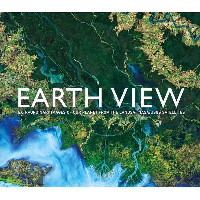
<p/><br></br><p><b> About the Book </b></p></br></br><b>See our planet as never before with this collection of more than 200 high-definition satellite photos of Earth.</b> <p/> Using images from NASA's Landsat satellite program, <i>Earth View</i> takes you on a journey of discovery around the globe, reveali<p/><br></br><p><b> Book Synopsis </b></p></br></br>Using images from NASA's Landsat satellite program, <i>Earth View</i> takes you on a journey of discovery around the globe, revealing in stunning detail the extraordinary geological features, manmade structures, and natural wonders as they appear from above. Reaching across all continents, and including remote glaciers, volcanic fields, shifting sands, and frozen wastelands, these 200 high-definition images inspire a fresh perspective on our planet.<p/><br></br><p><b> About the Author </b></p></br></br>About the LANDSAT program: <br> This joint NASA/USGS program provides the longest continuous space-based record of Earth's land in existence. Every day, Landsat satellites provide essential information to help land managers and policy makers make wise decisions about our resources and our environment.
Price History
Cheapest price in the interval: 28.49 on October 22, 2021
Most expensive price in the interval: 28.49 on November 8, 2021
Price Archive shows prices from various stores, lets you see history and find the cheapest. There is no actual sale on the website. For all support, inquiry and suggestion messagescommunication@pricearchive.us